LittlePig wrote:
And I can't think of any reason you would make the comment you made if you weren't suggesting that the find favored your view of a worldwide flood.
Umm, because simply it's a better explanation? And the fact that it's more consistent with the Flood Model doesn't hurt either.
Except, of course, it isn't consistent with a 'Flood Model', since it isn't mixed in with any animals that we know are modern.
Before the rabbits multiply beyond control, I'll just leave my proposal as a rapid burial. Nothing more than that. For this thread, it can just be a giant mud slide.
Since it's still spring time, let's let the rabbits multiply.
Questions for Debate:
1) Does a Global Flood Model provide the best explanation for our current fossil record, geologic formations, and biodiversity?
2) What real science is used in Global Flood Models?
3) What predictions does a Global Flood Model make?
4) Have Global Flood Models ever been subjected to a formal peer review process?
"Well thanks a lot, Plato." - James ''Sawyer'' Ford
"Don''t flip ya lid." - Ricky Rankin
Scotracer wrote:1) We have discovered and accurately analysed how many planets? Between 8 (of the planets) and say...30+ (including satellites)? This, in an infinitely large universe doesn't seem to be even inconclusive evidence of anything. It's an argument from ignorance.
Argument from ignorance? No, it's a testable prediction. Further, the universe is not infinitely large.
2) The seismic 3D model thingy doesn't show a uniform, global collection of water.
I don't claim there currently exists a uniform, global collection of water. That was pre-flood. Practically all of the water is now on the surface. But, one would expect at least pockets of water to have been trapped. This is what the study shows. As this diagram shows, the pockets of water are generally underneath the continents, and not underneath the oceans.
It shows some, in specific regions whereas other regions are completely devoid of, as the article puts it "This anomaly is believed due to water that has been pumped into the lower mantle via the long history of the subduction of oceanic lithosphere -- crust and upper mantle -- in this region."
If this is true, then water should be concentrated at the subduction zones. However, this is not the case. The FM explains the data better than SG.
Have you calculated the mass of water required for your proposed hypothesis?
I don't see where you are going with this question.
Does it conflict with known physics and thermodynamics?
If it does, please point it out.
Are you aware that your assumptions on early earth are unfounded?
How would you know what the early Earth was actually like?
How do you reconcile the fact that at the plate edges volcanoes are found (see Pacific Ring of Fire) showing that if these were indeed the leakage fractures where the water came out of the chambers, the conditions within the chambers was hot enough to melt rock?
Why did it from a "ring"? Why would these places be places of "fire"? The ring of fire is not where the fractures occurred, it is only at the oceanic ridge. The ring of fire is a result of the crust being collapsed by the water underneath it leaving it as I've explained here.
Are you assuming/speculating that mountains weren't as tall "pre-flood" so that a global flood is more feasible? What other reasons are you assuming such?
It is an assumption, but a reasonable one. If I can explain how all the major mountains are formed by the flood, then there are no mountains left for the pre-flood.
Scotracer wrote:1) We have discovered and accurately analysed how many planets? Between 8 (of the planets) and say...30+ (including satellites)? This, in an infinitely large universe doesn't seem to be even inconclusive evidence of anything. It's an argument from ignorance.
Argument from ignorance? No, it's a testable prediction. Further, the universe is not infinitely large.
Well it is testable but not by only using data from a few planets from our solar system then extrapolating that out to the entire universe. Going from 30 total planets & satellites to say that works for 1,000,000,000,000 possible planets (and that could be a conservative estimate) is highly questionable...to say the least.
otseng wrote:
2) The seismic 3D model thingy doesn't show a uniform, global collection of water.
I don't claim there currently exists a uniform, global collection of water. That was pre-flood. Practically all of the water is now on the surface. But, one would expect at least pockets of water to have been trapped. This is what the study shows. As this diagram shows, the pockets of water are generally underneath the continents, and not underneath the oceans.
You are making lots of claims about this "pre-flood" era. Please provide data for your assertions otherwise Occam's razor shows it to be dismissable.
otseng wrote:
It shows some, in specific regions whereas other regions are completely devoid of, as the article puts it "This anomaly is believed due to water that has been pumped into the lower mantle via the long history of the subduction of oceanic lithosphere -- crust and upper mantle -- in this region."
If this is true, then water should be concentrated at the subduction zones. However, this is not the case. The FM explains the data better than SG.
So you are going to argue against real geologists on this matter, simply because it doesn't fit your hypothesis? Wow.
And even in your own link it mentions that the water is boiled away and then being pooled:
""That is exactly what we show here, the exact depth and high attenuation amounts right above it," Wysession said. "I call it the Beijing anomaly. Water inside the rock goes down with the sinking slab and it's quite cold, but it heats up the deeper it goes, and the rock eventually becomes unstable and loses its water. The water then rises up into the overlying region, which becomes saturated with water.
"If you combine the volume of this anomaly with the fact that the rock can hold up to about 0.1 percent of water, that works out to be about an Arctic Ocean's worth of water.""
otseng wrote:
Have you calculated the mass of water required for your proposed hypothesis?
I don't see where you are going with this question.
To see if the volume you are talking about is even feasible. Basic science work, my dear boy.
otseng wrote:
Does it conflict with known physics and thermodynamics?
If it does, please point it out.
Well I'm still waiting on your presenting any actual data rather than some pretty pictures drawn by Creationists.
otseng wrote:
Are you aware that your assumptions on early earth are unfounded?
How would you know what the early Earth was actually like?
I don't claim to know but I do know that your claims have no backing in evidence. I'm not making any claims about early Earth - I would like to know how you can make any claims on it without the data before hand.
otseng wrote:
How do you reconcile the fact that at the plate edges volcanoes are found (see Pacific Ring of Fire) showing that if these were indeed the leakage fractures where the water came out of the chambers, the conditions within the chambers was hot enough to melt rock?
Why did it from a "ring"? Why would these places be places of "fire"? The ring of fire is not where the fractures occurred, it is only at the oceanic ridge. The ring of fire is a result of the crust being collapsed by the water underneath it leaving it as I've explained here.
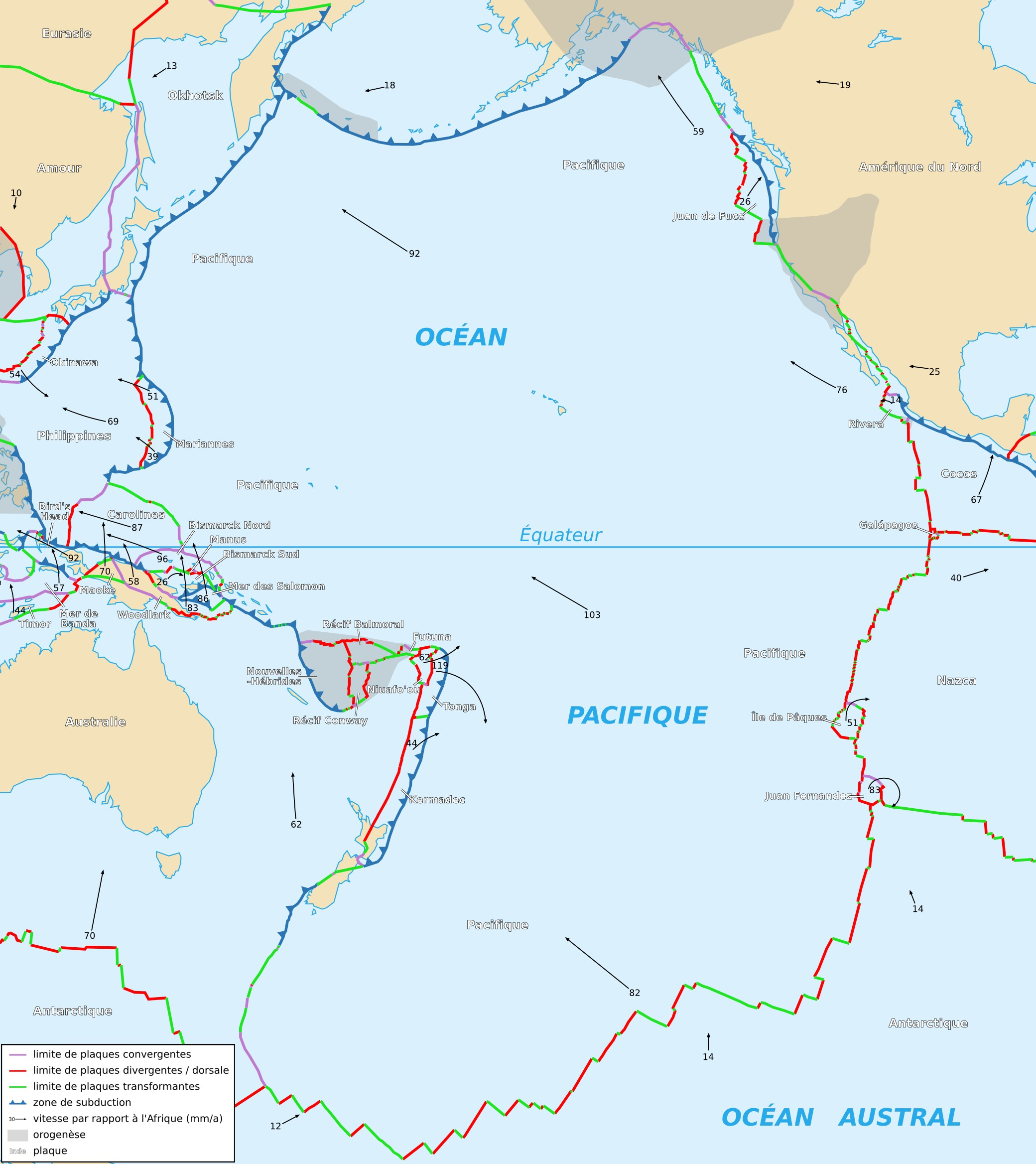
Well it's a ring because, y'know the plate is pretty circular. Here's a pretty picture of it:
Well as it would be obvious to someone with even a high school level of geographic and geological education, the edges of plates are where the vast majority of volcanoes in the world are situated. The gaps between the places force up magma, creating volcanoes.
And your claim about the collapse of the crust causing the fault: prove it to be even possible. I'd like to see the maths.
otseng wrote:
Are you assuming/speculating that mountains weren't as tall "pre-flood" so that a global flood is more feasible? What other reasons are you assuming such?
It is an assumption, but a reasonable one. If I can explain how all the major mountains are formed by the flood, then there are no mountains left for the pre-flood.
[/quote]
But we know how many mountain ranges formed. We know that some mountain ranges in the world are still rising due to tectonic movement. But again, each mountain range is different. You cannot just lump everything together with some assumptions and blanket statements like you have throughout this thread. You must look at each one individually.
Please look at Orogeny. This replaced the concept of the flood, almost 200 years ago. Your claims are nothing new and were replaced long ago.
Without the last Ice Age as a basis for UK geology (as well as a lot of Northern Europe), the land forms found don't make any sense. They were formed by glacial movement - and yes, I have studied them quite extensively.
goat wrote:When you have hills and valleys, and hills erode, then fossils that are found in hills can be found in the valleys, above the layer they originally were.
All instances of K-T boundaries that I've seen have been relatively straight. Can you demonstrate this type of activity where reworked fossils have been found?
If you found a skeleton that was intact, that would falsify that explaination ination.However, little bits and pieces where you find extreme small percentages of the total skeleton, that is a good deduction of the evidence.
How about this for falsification? If it can be demonstrated that dinosaur fossils are above the K-T boundary and that it was not a result of being reworked, would it falsify it?
Are you sure?? Were you ever around the area where the K-T boundery was exposed? Was the K-T boundery that was exposed in a hill?? I have often seen that boundery pointed out in science programs in cliff faces.
When you put a layer of dust on top of mounds, is the layer of dust flat?
“What do you think science is? There is nothing magical about science. It is simply a systematic way for carefully and thoroughly observing nature and using consistent logic to evaluate results. So which part of that exactly do you disagree with? Do you disagree with being thorough? Using careful observation? Being systematic? Or using consistent logic?�
At this point where we've circled around for over 30 pages (at 10 posts per page), reaching a total of over 320 posts I feel I should conclude things to see exactly what has been addressed and what hasn't. In Zzyzx and Otseng's debate thread Zzyzx posting a list of things that hadn't be addressed there. Let's see if in the past 18 months those holes have been filled in:
Zzyzx wrote:1. Origin of the flood water (without unproven assumptions of �Hydroplate Theory�)
2. Disposal of water post-flood (ditto)
Note: If you cannot �explain� the appearance and disappearance of sufficient water to flood the Earth �to the tops of hills� without relying on the �Hydroplate Theory�, you acknowledge that if that theory is not valid you have no explanation.
3. Survival of fish (without claiming that �they live in water so they survived�)
4. Survival of plants in a year of flooding (particularly those that do not reproduce by seeds)
5. Evolution of fish and plants occurring rapidly post-flood but slowing currently
6. Accumulation of animals from all over the globe at the ark (without transportation)
7. Return of animals to their specific habitats post-flood (ditto)
8. Mountains being �lower� a few thousand years ago, rising rapidly, stopping rise
9. Continents being shoved apart by water pressure (and continuing to move)
10. Building and sailing by 8 people of a wooden ship larger than any known to have been built
11. Care and feeding of thousands or millions of animals for a year on a boat
12. 100% survival of all pairs of animals
13. Atmosphere being a �blanket of water� and �no rain� before the flood
14. Earth�s climate being significantly more mild a few thousand years ago
15. Genetic diversity in humans evolving rapidly post-flood to produce variations now present � then slowing or stopping.
16. Precise sorting of fossils in sedimentary rocks � so perfect that no fossil of any animal or plant is found lower in the stratigraphic column than would be consistent with when it evolved according to stratigraphy and paleontology.
These are MAJOR issues that you have NOT managed to �explain� in order to defend the biblical flood described in genesis as being literally true. The absence of a reasonable discussion of major issues is an indication that the position being defended is weak and unsupportable OR the debater is incapable. I conclude that the latter is not the case.
And to be perfectly honest, I do not see any of those being fulfilled to this date. So have we just spent the last 320+ posts doing basically nothing? I sure hope not.
You may note that I have bolded the Note made by Zzvzx. The Hydroplate "Theory" is the central argument for the entire Flood Model. Now, I say we focus on that for now as there is (as can be seen from the list) so much left unaccounted for.
Just for reference, this is what TalkOrigins responds with, in regards to the Hydroplate hypothesis:
The rock that makes up the earth's crust does not float. The water would have been forced to the surface long before Noah's time, or before Adam's time for that matter.
Even two miles deep, the earth is boiling hot (260 to 270 degrees C at 5.656 miles in one borehole; Bram et al. 1995), and thus the reservoir of water would be superheated. Further heat would be added by the energy of the water falling from above the atmosphere. As with the vapor canopy model, Noah would have been poached.
The escaping waters would have eroded the sides of the fissures, producing poorly sorted basaltic erosional deposits. These would be concentrated mainly near the fissures, but some would be shot thousands of miles along with the water. Such deposits would be quite noticeable but have never been seen.
All of the above have been mentioned in this thread previously, and not accounted for.
A good video series made by "Potholer54" on Youtube debunks misc Creationist claims. Here is the series on the Biblical Flood:
Part 1:
Part 2:
Brought up in the series:
Stratafication
Geological Column
Kent Hovind Lies (no video is a video without that)
Mt St Helens Pyroclast
Chalk Formation
Fossilised Coral strata
Coal and oil being found on top of fossilised coral
Distribution of fossils
Nothing new in the videos but they are summarised very well, very eloquently put and adds a few extras we haven't touched on yet.
On the topic of the water canopy I refer you all to Thunderf00t's brilliant series entitled "Why do people laugh at Creationists?" Part 5:
Summary of the video:
Water canopy is not gravitationally viable
An "ice canopy" would break, due to stress, if it were not of ridiculous thickness
If it WERE ridiculously thick no light would reach the earth's surface
An ice canopy, when falling to earth would kill almost all living things
In conjunction with a requirement to be thick to not fracture, it would have to be extremely thick (quite an apt statement, I believe) so as to last any amount of time without melting
Sun would melt 0.5m of ice per day - for it to last 2000 years (according to bible) it would need to be miles thick
If the canopy was in orbit, rather than "on" the atmosphere it could not be water as water would heat to incandescence due to friction at orbital speeds
If it were ice and it "fell" to earth it would heat up by at least 1000C. Basically killing all life
If it were sitting on the atmosphere, it would compress the atmosphere to the extreme. As this fractured all life would explosively decompress
Let's do some maths.
Known facts of the earth:
Tallest mountain: 8,848 metres
Earth circumference: 40,041.47 Km (mean)
Ice Specific Volume: 1.09 (average)
Volume of sphere:
Volume of water required to cover earth (from sea level to peak of Everest): 4.52x10^24m³ water
Assuming it is sitting on the atmosphere (and using 108km as thickness of atmos):
Thickness of Ice shield: 8841.41m @ 10%
That thickness of water (ice has virtually the same optical properties as water) would allow zero light to earth's surface - see here:
That is a hell a lot of water, Otseng. And that is assuming just 10% is forming an ice shield. I'm trying to help your case here. That much water just isn't going to be floating about. Also:
Melting (@0.5m per day):
48 years before total failure.
And when that does fail, it will explosively decompress everything on earth.
PS: I recommend all watch that entire series as it is entertainment even if you knew it all, already.
Otseng, so far in this thread you have brought two pieces of evidence to support the concept of water deep underground: The superdeep borehole and the 3D Seismic analysis of the planet. The first one only shows that it is physically possible to have water at great depths. The 2nd has been accounted for by modern and "standard" geology - subduction.
So, please present any relevant information for this theory and relevant calculations giving educated estimates to what is required.
The first question I wish to pose with regards to the hypothesis: Where did the water go? Now remember, you cannot answer a question by posing another unsupported assertion. That is just moving the argument around. I'd like to see some real evidence.
micatala wrote:I think we could do some experiments to test this. Place a cinderblock on dry pavement and try to push it, measuring the force. Now, place the same cinderblock in a submerged tank with the same bottom material as the pavement and push. My guess is you will not get a significant decrease in the coefficient of friction. I'll put a cup of coffee up that it will be less than a 20% reduction.
The FM doesn't state that after the subterranean water left that the crust moved significantly after it hit the basalt layer underneath. Actually, it would've at that point slowed down and buckled. The crust moved while there was still water between the crust and the basalt. So, the crust was sliding on water as it was sinking.
So, if I am understanding you correctly, the crust was being supported by the water, held up because the water was confined and under pressure and not able to escape.
If this is the case, then we need to get into the calculation of the weight of the crust being held up and how much water it would take to do that, and what would the effect on the water be of having that much weight on it.
" . . . the line separating good and evil passes, not through states, nor between classes, nor between political parties either, but right through every human heart . . . ." Alexander Solzhenitsyn
goat wrote:
And, that is when it is in a solid mass. The irridium layer is extremely thin, and just a few layers of atoms through out the entire world.
There are a few points I would contend with. First, I think it's more than a few layers of atoms in width. Also, I would ask for evidence that it spread uniformly over the entire world.
Since it was because it was vaporised and spread over the entire world quite thin, how can you tell if this thin layer is 'meteoric' in nature. Your articles do not take that into account.
Scotracer wrote:Your climate links only suggest that the poles were warmer. They do not suggest that the entire planet was of a uniform climate. The climate of the earth has varied VASTLY over it's life. Remember, we're still in an ice age. By stating that it was more uniform you are supposing that equatorial regions hadn't changed during that time. Got any data for that?
Certainly the equatorial regions could a bit different, but I think it's safe to say that the if the polar regions were tropical, the equatorial regions would not be freezing, but remain tropical.
Please re-read your quote "The fossil wood recovered from the dive-site is typified by a lack of distinct growth ring development."
Scotracer wrote:Your climate links only suggest that the poles were warmer. They do not suggest that the entire planet was of a uniform climate. The climate of the earth has varied VASTLY over it's life. Remember, we're still in an ice age. By stating that it was more uniform you are supposing that equatorial regions hadn't changed during that time. Got any data for that?
Certainly the equatorial regions could a bit different, but I think it's safe to say that the if the polar regions were tropical, the equatorial regions would not be freezing, but remain tropical.
No you can't present evidence of a uniform climate by assuming the conditions of everything but the poles.
What you are in essence doing is:
You: "Look, the climate was more uniform in the past - the poles were warmer at some point!"
Someone else: "What about the rest of the planet? What climate was that like?"
You: "Dunno but probably the same. Therefore I've proved my point".
That just wont stand - sorry.
And what if the current tropical climate is actually cooler than it used to be - particularly during the time when the poles are as described in your links? See, you can't use a single point on the earth as evidence of a worldwide condition - just as you can't use small regional anomalies (such as that borehole) as evidence of a worldwide flood. It doesn't make any sense.
otseng wrote:
Please re-read your quote "The fossil wood recovered from the dive-site is typified by a lack of distinct growth ring development."
"To embody, exemplify; to represent by an image, form, model, or resemblance."
"To serve as a typical or reference specimen."
Exemplify
1: to show or illustrate by example <anecdotes exemplifying those virtues>
2: to make an attested copy or transcript of (a document) under seal
3 a: to be an instance of or serve as an example : embody <she exemplifies the qualities of a good leader> b: to be typical of <a dish that exemplifies French cuisine>
Typify is the what sets this dive apart - what is most important about it. If it was the case that no trees had rings before whatever period you wish to claim then the word typify wouldn't be necessary - the condition would be expected.
It's not science and it's not honest.
Questioning my honesty would be an ad hominem fallacy. If you have counterevidence, please present that instead.[/quote]
Consider it presented above.
My next query:
We have seen a fairly consistent rate of increase in height of the Himalayas (~5cm/year) and this is known to be caused by the Indian landmass colliding with Asia. This rate is pretty consistent and has been for some time. I thought you said the mountains were formed at this flood event?
Scotracer wrote:1) We have discovered and accurately analysed how many planets? Between 8 (of the planets) and say...30+ (including satellites)? This, in an infinitely large universe doesn't seem to be even inconclusive evidence of anything. It's an argument from ignorance.
Argument from ignorance? No, it's a testable prediction. Further, the universe is not infinitely large.
Well it is testable but not by only using data from a few planets from our solar system then extrapolating that out to the entire universe. Going from 30 total planets & satellites to say that works for 1,000,000,000,000 possible planets (and that could be a conservative estimate) is highly questionable...to say the least.
No, I'm not extrapolating out the evidence from our own solar system to others. I'm making a prediction that falls out from the model.
Well, if no plate tectonics are found on a trillion planets, would it then confirm the model?
otseng wrote:
2) The seismic 3D model thingy doesn't show a uniform, global collection of water.
I don't claim there currently exists a uniform, global collection of water. That was pre-flood. Practically all of the water is now on the surface. But, one would expect at least pockets of water to have been trapped. This is what the study shows. As this diagram shows, the pockets of water are generally underneath the continents, and not underneath the oceans.
You are making lots of claims about this "pre-flood" era. Please provide data for your assertions otherwise Occam's razor shows it to be dismissable.
If we're going to use Occam's razor, then the FM would be a single explanation for many of the features we see. Whereas in SG, many things have been proposed to explain the same things.
So you are going to argue against real geologists on this matter, simply because it doesn't fit your hypothesis? Wow.
By that logic then, are you going to argue against real theologians simply because it doesn't fit your worldview?
""That is exactly what we show here, the exact depth and high attenuation amounts right above it," Wysession said. "I call it the Beijing anomaly. Water inside the rock goes down with the sinking slab and it's quite cold, but it heats up the deeper it goes, and the rock eventually becomes unstable and loses its water. The water then rises up into the overlying region, which becomes saturated with water.
There are several problems with this. First, the mantle is solid rock. Solid metamorphic/igneous rock is not known to absorb and carry water. Further, even if it could, the suppossed mantle convection cycle is in the opposite direction. Also, there should still exist a significant evidence of water at the subduction zones if that is where water is entering the Earth.
otseng wrote:
Have you calculated the mass of water required for your proposed hypothesis?
I don't see where you are going with this question.
To see if the volume you are talking about is even feasible. Basic science work, my dear boy.
Still not sure what you're driving at. But anyways, the amount of water during the flood is the same as the amount of water on the Earth now. From this chart, the volume of water is 1,346,858,000 cubic km.
If the surface of the Earth was flat and using a radius of the Earth as 6371 km, this would mean water would be a depth of 2.64 km (1.64 mi) if it covered the entire Earth.
Well it's a ring because, y'know the plate is pretty circular.
That's circular logic. (I could't help myself)
Without the last Ice Age as a basis for UK geology (as well as a lot of Northern Europe), the land forms found don't make any sense. They were formed by glacial movement - and yes, I have studied them quite extensively.


