A Deluge of Evidence for the Flood?

Creationism, Evolution, and other science issues

Moderator: Moderators

Post Reply
User avatar
LittlePig
Sage
Posts: 916
Joined: Mon Feb 04, 2008 1:51 pm
Location: Dallas, TX

A Deluge of Evidence for the Flood?

Post #1

Post by LittlePig »

otseng wrote:
goat wrote:
otseng wrote:
LittlePig wrote: And I can't think of any reason you would make the comment you made if you weren't suggesting that the find favored your view of a worldwide flood.
Umm, because simply it's a better explanation? And the fact that it's more consistent with the Flood Model doesn't hurt either. ;)
Except, of course, it isn't consistent with a 'Flood Model', since it isn't mixed in with any animals that we know are modern.
Before the rabbits multiply beyond control, I'll just leave my proposal as a rapid burial. Nothing more than that. For this thread, it can just be a giant mud slide.
Since it's still spring time, let's let the rabbits multiply.

Questions for Debate:

1) Does a Global Flood Model provide the best explanation for our current fossil record, geologic formations, and biodiversity?

2) What real science is used in Global Flood Models?

3) What predictions does a Global Flood Model make?

4) Have Global Flood Models ever been subjected to a formal peer review process?
"Well thanks a lot, Plato." - James ''Sawyer'' Ford
"Don''t flip ya lid." - Ricky Rankin

User avatar
Scotracer
Guru
Posts: 1772
Joined: Tue Apr 28, 2009 5:25 pm
Location: Scotland

Post #251

Post by Scotracer »

Right, so we have one instance of water being found at a ridiculous depth. How does one extrapolate that up to a world-wide water chamber system that actually supported the crust enough to cause tectonic movement? I mean science works by you finding some data first and coming to your conclusion years or decades later with mountains of evidence. What you are doing is reading the bible, using that as your conclusion and trying to fit some evidence in to support it. As has been said many times in this thread, that is not science.

And the evidence of some water down that low (and I couldn't find any values on the mass of water found) doesn't contradict the other issues found with such a concept. I just tried to find a average Young's Modulus for the Earth's Crust but I cannot see why it can't be similar to that of wood.
Why Evolution is True
Universe from nothing

Claims made without evidence can be dismissed without evidence
- Christopher Hitchens

User avatar
otseng
Savant
Posts: 20984
Joined: Thu Jan 15, 2004 1:16 pm
Location: Atlanta, GA
Has thanked: 218 times
Been thanked: 393 times
Contact:

Post #252

Post by otseng »

Grumpy wrote:The Himalayas are probably the youngest mountain range, then the Rockies, the Andes and the Appalachians are the oldest(by quite a lot). They were not formed within even 10s of millions of years of each other, much less formed overnight. The Appalachians, in particular, have undergone hundreds of millions of years of erosion and were ancient when dinosaurs did not yet exist.
Mountain ranges have evidence of originally being formed underwater. This is easily accounted for by the FM. In the SG, why should mountains have originally come from underwater? Shouldn't there at least be a roughly equal amount that was formed above water?

"The summit of Mt. Everest is marine limestone."
http://geology.about.com/library/bl/peaks/bleverest.htm

"There are many big ammonite fossils in the Muktinath area of the Kali Gandaki valley, Nepal at around the elevation of 12,000 ft above sea level."
http://library.thinkquest.org/10131/geology_visual.html

"Scientists have found fossils of whales and other marine animals in mountain sediments in the Andes, indicating that the South American mountain chain rose very rapidly from the sea."
http://www.nytimes.com/1987/03/12/us/wh ... m-sea.html
The ice sheet would've had to erode it nearly flat for an extensive area. Also, from my understanding, gravity is the main force for ice movement on land. And the flatter the surface, the lower the force of gravity to move the ice.
So??? Time is one thing this Earth has had in abundence. 4.5 billion years is nearly one third of the time that the Universe itself has existed, the total amout of time itself has existed.
We're talking about step 3 of the Siccar Point Angular Unconformity. 4.5 billion years does not apply to this.
Also just meters away from Hutton's Unconformity, it obviously was not eroded flat. How could that be accounted for? Why would the ice sheet "go around" that spot? Are there any other spots that the ice sheet went around?
Again, So??? I do not know the details of what the geology of that particular spot is, and I would not presume to try to read the history of the area represented by the limited photos I have seen of it.
We're looking at it since the Hutton Unconformity was brought up as evidence by perfessor.
The water canopy is just physically impossible.
The only thing that has been shown is that the water canopy could not have been the only source of water for the flood. And I have not claimed that.
The "Undersurface waters" is impossible as well.
We already have evidence of water existing at 40000 ft under the surface.
The Mid Atlantic ridge is not an artifact of water erruption, but is the seam of volcanic activity that is driving Europe and North America apart to this day.
We can get to that soon enough.
There is no worldwide evidence of a flood, as there IS of an impact event 65 million years ago that wiped out the dinosaurs.
If you're talking about the Chicxulub impact, that claim is disputable.
"We found that not a single species went extinct as a result of the Chicxulub impact," said Keller, according to a Princeton release.
http://www.themoneytimes.com/20090427/a ... 65516.html

User avatar
Grumpy
Banned
Banned
Posts: 2497
Joined: Mon Oct 31, 2005 5:58 am
Location: North Carolina

Post #253

Post by Grumpy »

otseng
Mountain ranges have evidence of originally being formed underwater. This is easily accounted for by the FM. In the SG, why should mountains have originally come from underwater? Shouldn't there at least be a roughly equal amount that was formed above water?
Mountain ranges are formed by geological stress, That some parts of them once were under water in no way means they were formed underwater(though it does not rule out that some were). EACH MUST BE CONSIDERED SEPARATELY.
We're talking about step 3 of the Siccar Point Angular Unconformity. 4.5 billion years does not apply to this.
Nor does sudden or "flood" related timeframes. We are still talking about millions of years.
The only thing that has been shown is that the water canopy could not have been the only source of water for the flood. And I have not claimed that.
I beg to differ, the "water canopy" itself has been shown to be outside of the realm of the possible.
We already have evidence of water existing at 40000 ft under the surface.
Finding water under the Earth is well known, floating continents on huge underground aquifers is not. We find gasses underground, but that does not mean the Earth is blown up like a huge basketball.
The Mid Atlantic ridge is not an artifact of water erruption, but is the seam of volcanic activity that is driving Europe and North America apart to this day.


We can get to that soon enough.
You brought it up in your claims in the thread you insisted we read first. It is aa ludicrous claim based on total ignorance of the evidence(at best). The widening of the rift is observable in Iceland on a daily basis. Not water, lava.
There is no worldwide evidence of a flood, as there IS of an impact event 65 million years ago that wiped out the dinosaurs.
If you're talking about the Chicxulub impact, that claim is disputable.
My point still stands, the evidences for that event are visible worldwide, at least the dispute is using real evidence. No such evidence of a worldwide flood event, in any era, is to be found.
Quote:

"We found that not a single species went extinct as a result of the Chicxulub impact," said Keller, according to a Princeton release.

http://www.themoneytimes.com/20090427/a ... 65516.html
Keller's is not the opinion of most scientists studying the event. In any case even Keller acknowledges that there are dinosaur fossils in layers below the KT boundary and none above. And he also dates the KT layer to 65 MILLION years ago. His argument is that the dinosaurs went extinct prior to the event, not that the event did not happen and not that the event was not 65 million years before the present. You cannot misuse Keller's argument about the cause of the extinction as supporting the flood myth or to cast doubt on scientific methods, though it is a favorite tactic of creationists. I expect more honesty from you.

Grumpy 8-)
"Fear of God is not the beginning of wisdom, but it''s end." Clarence Darrow

Nature is not constrained by your lack of imagination.

Poe''s Law-Without a winking smiley or other blatant display of humor, it is impossible to create a parody of Fundamentalism that SOMEONE won''t mistake for the real thing.

User avatar
micatala
Site Supporter
Posts: 8338
Joined: Sun Feb 27, 2005 2:04 pm
Has thanked: 1 time

Post #254

Post by micatala »

otseng wrote:
Brown's scenario, there would be no way to absolutely eliminate all the subterranean water.
I would agree with that. There should be some residual water left. And one evidence of it is from the Kola borehole.
But what about the lack of "dead seismic zones" referred to? Shouldn't there be a lot more water than one might find in this hole and other possible not yet located holes?
" . . . the line separating good and evil passes, not through states, nor between classes, nor between political parties either, but right through every human heart . . . ." Alexander Solzhenitsyn

User avatar
otseng
Savant
Posts: 20984
Joined: Thu Jan 15, 2004 1:16 pm
Location: Atlanta, GA
Has thanked: 218 times
Been thanked: 393 times
Contact:

Post #255

Post by otseng »

Scotracer wrote:Right, so we have one instance of water being found at a ridiculous depth. How does one extrapolate that up to a world-wide water chamber system that actually supported the crust enough to cause tectonic movement?
It is only one of many data points to support the model. I don't claim it's the only evidence. But, I will make an additional prediction regarding this, when other superdeep holes are drilled, the Kola Superdeep Borehole will not be the only one to find water.

There is something else interesting that they found:
"The rock there had been thoroughly fractured and was saturated with water, which was surprising."

This would also be explainable by the FM. The impact between the two layers of rock would cause fractures at the boundary.

User avatar
otseng
Savant
Posts: 20984
Joined: Thu Jan 15, 2004 1:16 pm
Location: Atlanta, GA
Has thanked: 218 times
Been thanked: 393 times
Contact:

Post #256

Post by otseng »

Grumpy wrote:Mountain ranges are formed by geological stress, That some parts of them once were under water in no way means they were formed underwater(though it does not rule out that some were).
What I'm saying is that the layers themselves were formed underwater. Orogenic events occurred to then bend the layers to form mountains. Shouldn't orogeny also happen to rocks on land?
We are still talking about millions of years.
And after millions of years of erosion, even if it was an ice sheet, the end result is a flat surface? Where do we see such things occuring?
Finding water under the Earth is well known, floating continents on huge underground aquifers is not.
Not at depths of 40000 ft. As for floating continents, plate tectonics even posit that plates "float" on rocks. What does that mean? Things that float on water is more intuitive than things that float on rocks. And it provides a more reasonable mechanism for plate movement than does plate tectonics.
find gasses underground, but that does not mean the Earth is blown up like a huge basketball.
Nobody is claiming that.
You brought it up in your claims in the thread you insisted we read first. It is aa ludicrous claim based on total ignorance of the evidence(at best). The widening of the rift is observable in Iceland on a daily basis. Not water, lava.
Actually, the evidence supports the FM better than does the plate tectonics explanation. The FM does not posit that water is currently widening the rift. But that the entire oceanic ridge was formed during the flood. Plate tectonics says that lava is pushing the plates apart and created the oceanic ridge. But, when lava comes out of the ground, is comes out radially, not forming straight lines. Yet, the oceanic ridges is marked by straight lines, not curves. This shows that lava coming out of the ground did not form the ridges.
You cannot misuse Keller's argument about the cause of the extinction as supporting the flood myth or to cast doubt on scientific methods, though it is a favorite tactic of creationists.
How did I "misuse" the article? I'm simply countering your claim "there IS of an impact event 65 million years ago that wiped out the dinosaurs." And that the Chicxulub impact has been shown to not cause their extinction.

User avatar
Scotracer
Guru
Posts: 1772
Joined: Tue Apr 28, 2009 5:25 pm
Location: Scotland

Post #257

Post by Scotracer »

otseng wrote:
Grumpy wrote:Mountain ranges are formed by geological stress, That some parts of them once were under water in no way means they were formed underwater(though it does not rule out that some were).
What I'm saying is that the layers themselves were formed underwater. Orogenic events occurred to then bend the layers to form mountains. Shouldn't orogeny also happen to rocks on land?
We are still talking about millions of years.
And after millions of years of erosion, even if it was an ice sheet, the end result is a flat surface? Where do we see such things occuring?
Finding water under the Earth is well known, floating continents on huge underground aquifers is not.
Not at depths of 40000 ft. As for floating continents, plate tectonics even posit that plates "float" on rocks. What does that mean? Things that float on water is more intuitive than things that float on rocks. And it provides a more reasonable mechanism for plate movement than does plate tectonics.
find gasses underground, but that does not mean the Earth is blown up like a huge basketball.
Nobody is claiming that.
You brought it up in your claims in the thread you insisted we read first. It is aa ludicrous claim based on total ignorance of the evidence(at best). The widening of the rift is observable in Iceland on a daily basis. Not water, lava.
Actually, the evidence supports the FM better than does the plate tectonics explanation. The FM does not posit that water is currently widening the rift. But that the entire oceanic ridge was formed during the flood. Plate tectonics says that lava is pushing the plates apart and created the oceanic ridge. But, when lava comes out of the ground, is comes out radially, not forming straight lines. Yet, the oceanic ridges is marked by straight lines, not curves. This shows that lava coming out of the ground did not form the ridges.
You cannot misuse Keller's argument about the cause of the extinction as supporting the flood myth or to cast doubt on scientific methods, though it is a favorite tactic of creationists.
How did I "misuse" the article? I'm simply countering your claim "there IS of an impact event 65 million years ago that wiped out the dinosaurs." And that the Chicxulub impact has been shown to not cause their extinction.
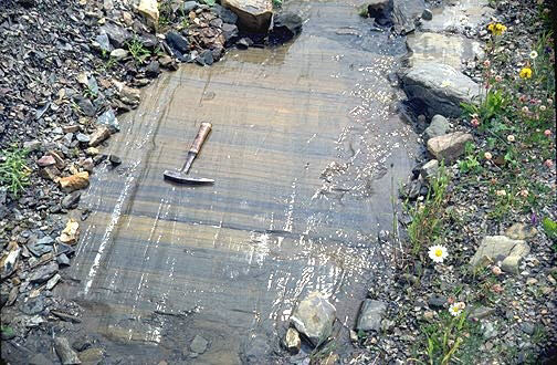
Glacial erosion:

Image

Otseng if I'm right in saying, the superdeep borehole was the deepest of its kind and therefore you would only get one instance of water at that depth, by definition? I note in the quote you held a post or two ago that the rock was "fully fractured". If what you propose occured the rock wouldn't have fractured as it collapse it would have melted with the energy and fused into new rock. Think of the forces in play here.
Last edited by Scotracer on Tue Jun 16, 2009 1:33 pm, edited 1 time in total.
Why Evolution is True
Universe from nothing

Claims made without evidence can be dismissed without evidence
- Christopher Hitchens

User avatar
otseng
Savant
Posts: 20984
Joined: Thu Jan 15, 2004 1:16 pm
Location: Atlanta, GA
Has thanked: 218 times
Been thanked: 393 times
Contact:

Post #258

Post by otseng »

micatala wrote: But what about the lack of "dead seismic zones" referred to? Shouldn't there be a lot more water than one might find in this hole and other possible not yet located holes?
I'm not able to determine what exactly is meant by a "dead seismic zone". Are you able to find out what this means?

Since the subterranean water is now on the surface of the Earth and the two rock layers have collapsed, I don't think there would be a significant amount of water at the boundary. But, there should at least be some water there. And as I mentioned earlier, this can be tested as we drill more superdeep holes in the future.

BTW, have you been able to think about my prediction that I gave earlier?

User avatar
micatala
Site Supporter
Posts: 8338
Joined: Sun Feb 27, 2005 2:04 pm
Has thanked: 1 time

Post #259

Post by micatala »

I did promise to respond to the predictions alluded to be otseng, and so although I have not fulfilled my promise to read through the whole other flood thread yet, I will give some response here.
otseng wrote:In standard geology, stratas are formed over long time periods (thousand, millions of years). Each successive strata are formed on top of older stratas. So, the entire strata sequence at any point in the world could span on the order of millions/billions of years.
Speaking without detailed geological knowledge, I will simply say that I agree stratas are generally formed over long periods, at least if there are multiple layers and especially if they show different characteristics. I agree newer strata are formed over old.

I would think, however, that at a given location, sedimentary strata could be either very thick or somewhat thin, and could represent varying periods of time. I could see that at a given location, sedimentary strata could be formed during era A, then no strata are formed for a time (perhaps a long time), then either more strata are formed on top of these or uplifting occurs at this location for a period, then erosion might occur, etc.

Also, I would think that in some cases, a thick (or maybe even a thin) layer could be layed down quickly, although it might take some additional time to harden. A volcanic mudflow (lahar sp?) for example could lay down a thick sedimentary layer in a short time on top of either other sedimentary layers, or other volcanic layers, and then one might get a lava flow on top of that. So could an ordinary water flood. So, I could see that you might find places where a single sedimentary layer occurs in isolation, without any adjoining sedimentary layers, and this layer would represent only a relative instant in geological time.

With this extra nuance, I would agree that the strata at a given location would usually, according to SG, span millions to perhaps billions of years.


In the Flood Model, practically all the stratas were formed within a short period (on the order of months). For almost all cases, only after all the stratas were formed, did things occur to the entire sequence like folding, faulting, erosion, etc. (More details on this in the link I provided above)

In standard geology, geological events should've occured throughout Earth's history, so these events should be evident in the stratas.

So, a prediction by the FM is that for the vast majority of cases, we should see folding/faulting/erosion that affects the entire rock stratas. In SG, we should see roughly a uniform distribution of folding/faulting/erosion in the stratas.

Assuming there were no additional sedimentation (or other types of layers) layed down after a flood and subsquent deformation, it seems to me the flood model prediction is reasonable. I guess I need clarification on what this model assumes is below the strata layed down by the global flood, and whether this model includes subsequent layers being layed down years after the flood.

In SG, my understanding is that what we see would vary greatly from location to location depending on where and when folding/faulting/erosion occurs. I am not sure I would expect a "uniform" distribution in the stratas.

One question I would have is how often does seismic or the effects of slow tectonic activity affect areas where strata are being layed down at the same time these strata are forming. To the extent that strata tend to form in flat areas, and especially marine environments like continental shelves, I would expect that these areas tend to be very quiet, seismically speaking, during periods where strata are forming.

Conversely, I would expect that in most areas where folding/faulting/erosion are occurring, sedimentary strata are not being layed down at the same time.


Now, over the long history of the earth, while I wouldn't expect "uniformity", I would expect to see instances of sedimentary layers subsequently undergoing folding, and faulting and this, I would think, would effect all they layers existing at the time the folding or faulting process was occurring. Erosion, on the other hand, as it works from the top down, would not effect all the layers, at least not simultaneously.


One questions this brings is up is whether the geologic history of the earth has any cycles of sedimentary strata formation, followed by folding and faulting, followed by more sedimentation at these various points. I believe some of the examples pointed to earlier in the thread do actually show this. I wouldn't expect to happen too often, as once an area experiences folding and faulting it seems to me it would be less likely to be in a flat configuration that would foster formation of sedimentary strata.


One prediction you did not make which I think follow from a flood, especially a recent one, is that we should find fossils of the life that existed at the time of the flood all mixed together. My understanding is that weight is the principle factor effecting sinking. THus, we should find heavier life forms in the lowest layers and the lightest life forms at the top, or at least a significant trend in this direction. We should find human fossils appearing in layers with other similarly sized fossils, even of dinosaurs, but especially neanderthals, australopithecines, homo erectus, homo habilis, etc.

We should find elephants with other similar sized four-footed dinosaurs at similar depths, even in the same locations if it is reasonable to think they lived in the same kind of habitat.

Many dinosaurs were very small. Assuming such dinosaurs lived in a tropical habitat, we would expect to see fossils of these with other similar sized tropical life forms like modern day monkeys, tapirs, ocelots, etc.

Insects should tend to be found in much more abundance in the highest layers.

We should find trilobites with other similarly sized marine life, like perhaps crabs, small fish, starfish, lobsters, etc.


That this one prediction is not even close to being true is a huge, huge hit against the FM, all by itself, without any of the other voluminous problems with the FM being mentioned.
" . . . the line separating good and evil passes, not through states, nor between classes, nor between political parties either, but right through every human heart . . . ." Alexander Solzhenitsyn

User avatar
micatala
Site Supporter
Posts: 8338
Joined: Sun Feb 27, 2005 2:04 pm
Has thanked: 1 time

Post #260

Post by micatala »

Here is my review in brief of the Global Flood thread.


The OP asked these questions
otseng wrote: How can a world-wide flood feasibly happen?
Where did all the water come from?
Where did all the water go?
What significance does it have on the CM?
What evidence are there of a global flood?
Right up front, I would like to offer an analogy for comparison.
How could Germany have feasibly won WWII?
What evidence is there that Germany won WWII?
I offer this as but one possible example. My point will be that, while the question "what evidence is there for the flood" is not irrelevant, we should remember that we can find many, many statements for which we can find some evidence. Another would be "the sun revolves around the earth." We need to also ask what evidence is there against the given statement. If the statement can be proved false, or at least to be very, very highly improbable, then examples of evidence for the statement or that are consistent with the statement, are really irrelevant.

Evidence that Germany won the war would be:
1) Evidence of its incredible military industrial complex at that time.
2) Evidence that Germany is in much better shape today than at least some of its adversaries (eg. France and Russia) in terms of its economic and politcal power.
3) The huge number of people that Germany killed. I believe we can say that Germany killed more people during the war than any of the other countries involved.

I could probably think of more, but will leave it at that for now.


Also on page 1, otseng offers the following:

A world-wide flood explains the following:
- Extinction of the dinosaurs
- Why the prehistoric world had large animals/plants and now it does not
- The origin of the Grand Canyon and other canyons
- The existence of the mid-Oceanic ridge
- The formation of the continental shelves
- The formation of ocean trenches
- Magnetic variations on the ocean floor
- The formation of submarine canyons
- The formation of coal and oil
- The existence of frozen mammoths
- The formation of major mountain ranges
- The phenomenon of parallel rock stratas
- The apparent jigsaw fit of the continents
Areas of agreement:
1) It is feasible that the world's population could have grown to its present population from the ark inhabitants in the time allowed. (Post #19)
2) That the climate of the earth at times in the past has been very different than what it is today, and in particular, it was warmer during the time when dinosaurs were alive.
3) That the continents were all or mostly part of one land mass at one time. That the Americas and Europs/Africa split and migrated apart and the mid-Atlantic ridge was (or is) being formed as part of this process.


The existence of the water canopy. How much water?
THe absence of rain before the flood.
That mountains at that time were much lower (how much lower?)
That there were subterranean water chambers.
Where the water is now.
Why Noah did not get poached or steamed. Otseng suggest the ark offered protection.
That the flood covered the entire world.
That the flood is consistent with the fossil record.
That the earth is only 10,000 years old and the flood happened about 2400 B.C.
Population growth equation (Post #19)
That the mid-atlantic ridge was formed by water gushing from the ST chambers. (post #27)


Problems with the FM that I felt were unaddressed.


Problems with the FM that I felt were very weakly addressed include:

THe subterranean water chambers:
otseng wrote: The water was trapped by granite above and basalt below. The rock doesn't have to "float". The crust encircles the entire earth, so there is no need for anything to float. Just like an egg shell doesn't have to float on top of the egg white. Furthermore, the water was in chambers, so there can be additional support between the two rock layers.
Quote:

Even a mile deep, the earth is boiling hot, and thus the reservoir of water would be superheated. Further heat would be added by the energy of the water falling from above the atmosphere. As with the vapor canopy model, Noah would have been poached.


Yes, the water was superheated. But, it lost a lot of it's energy during the rupture phase of the flood. Noah was in the ark so he avoided being "poached".

The formation of present day mountains.
otseng in Post #30 of the Global Flood Thread wrote: Actually, practically all the underwater ridges were formed as a result of the crust splitting. So, where you see a mountain range, the crust cracked at that point. As the water gushed out of the cracks, the hydrodynamic forces formed a mountain range.

The major land mountain ranges were formed as the water under the crust diminished. While there was water, the crust was free to move since water has a low friction coefficient. But once the water was gone, the crust hit the basalt underneath. With the large friction coefficient, the crust started to buckle. The crust had a huge lateral momentum as it was sliding away from the mid-Oceanic ridge. The momentum caused the crust to form the Rockies, Appalachians, Andes, Himalayas, etc.

Notice that the major mountain ranges of the Americas (Rockies, Andes) run parallel to the western coastline. Why is that? It is consistent with what should happen if the entire land mass was moving westward, then abruptly stopped. Sort of like what happens when a car crashes into a wall. If a car runs into a brick wall, the front of the car would buckle up
" . . . the line separating good and evil passes, not through states, nor between classes, nor between political parties either, but right through every human heart . . . ." Alexander Solzhenitsyn

Post Reply